1910 Annexation
With the opening of the Frisco's West-side repair shops between Division and Atlantic Streets, Springfield city leaders began the process of expanding the city limits to include this area. The city limits in 1909 had not changed since 1887 when North Springfield was incorporated into the city of Springfield.
North Springfield composed an area defined as starting at Lyon and Division street, going north on Lyon to Atlantic, turning east to Washington Avenue, turning south to Blaine, going east on Blaine to Sherman Avenue, turning south to Division and following Division Street west back to Lyon.
In 1886, the city of Springfield incorporated the area around North Springfield that started at the corner of Kansas and Division, went north to Kearney Street, then east to Fremont Avenue, then the line turned south and at Division Street, turned to the west, back to the beginning point.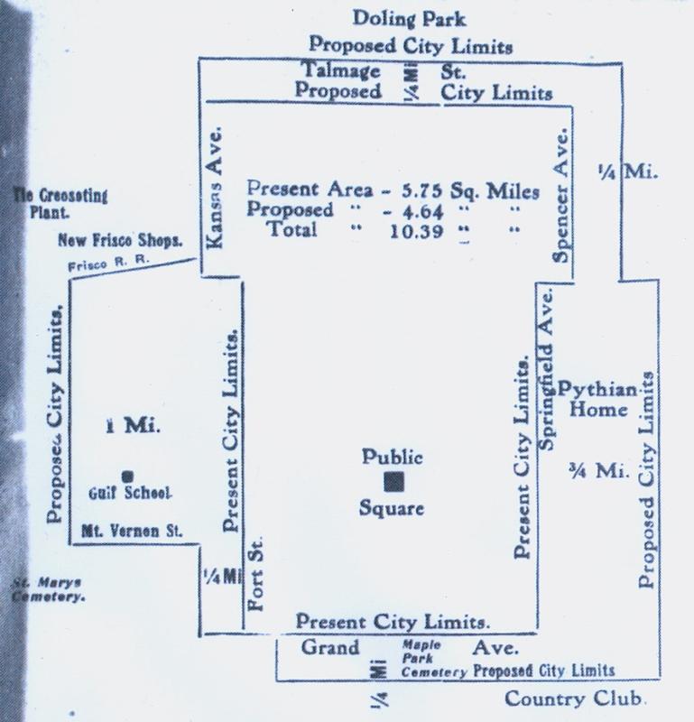
The original city limit expansion proposal was to add an area about one mile on the west side of city limits, south of the Frisco yards to Mt. Vernon Street, adding a quarter mile area on the North and South boundaries and a one quarter to three-quarter mile to the eastern boundaries of the city, as seen on the map, right, published in the January 9, 1910 Republican newspaper. Many street names have changed since that time, but the west boundary probably would have been the modern West Avenue, the southern line roughly follows the modern Catalpa Street. The eastern boundary that is 3/4 of a mile would be about where Glenstone is today. The 1/4 mile eastern limit was Lindell Avenue and would probably run near Delaware or Weller Avenues.
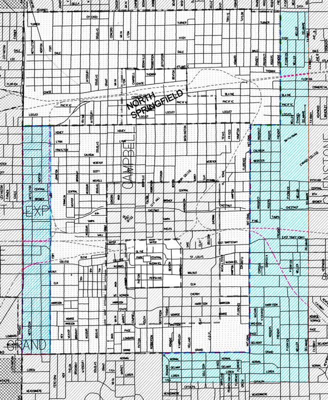
However, this proposal was later modified and encompassed a much smaller area, as shown in blue areas of the map on the left. The west city boundary started at Division and Kansas and ran south to Grand. The East side began at Kearney and Fairway and went south on the Fairway/Dollison street line to Catalpa, then west to Jefferson and north to Grand. This expansion was passed by vote in March 1910 as the new city limits.
In 1926 the city limits were again expanded to include the areas covered by the original proposal in the map above, but expanded further south to include Sunshine Street as the southern boundary. An area north of the West Frisco Shops to Kearney Street was also included in the new boundary.
See Springfield Republican articles on Newspapers.com, available through the library website. See also the history of the Springfield city limits in map form in the Library Center's map collection, case one drawer six.
Find this article at http://thelibrary.org/blogs/article.cfm?aid=4619&lid=62