 |
Volume IV, No. 1, Fall 1976 |
Ozark Rivers I
THE GEOLOGICAL STORY
Story by Danny Hough and photography by Danny Hough and Stephen Ludwig
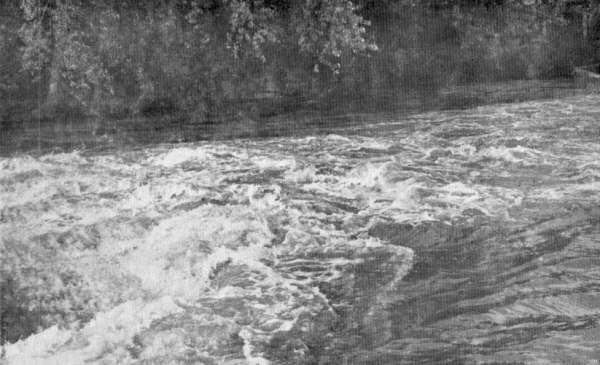
A long, high mud bank leads you around slow, flowing curves. Then, a final curve, and you shoot through rocky rapids, the banks changing to a sand bar, a gravel bar and finally to a huge outcropping of rock. Wonderous how in just a few hundred yards such a change could take place. Surely, you think, the diversity present can only be the result of dramatic actions and influences. But to be so peaceful now, one can hardly imagine the violent destructive and constructive forces once present. It is almost a miracle...
This miracle is actually a common sight along the Ozark rivers. The Ozarks, a geographic region located in south-central Missouri, north Arkansas and a small part of western Illinois and eastern Oklahoma and Kansas, is defined by its topography which is different from that of the surrounding regions. This difference was caused by the particular geologic history of the Ozarks. Because of the repeated uplifts and resulting deep erosion, the topography itself is one of hills, plateaus and deep valleys.
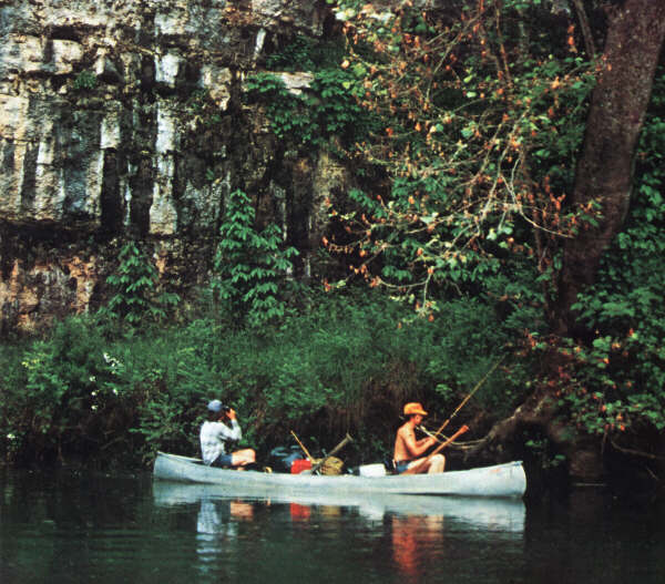
Osage Fork River below Orla.
[49]
The character of the rivers are the result of this land formation. To best understand just how and why the rivers are the way they are, it would be best to start at the beginning of the Ozarks.
About four hundred million years ago Missouri, Arkansas and the surrounding area consisted of a metamorphic (mixed sedimentary and granite) and igneous (molten) layer of rock. Ancient streams running over the land carved the surface into a topography much the same as today's Ozarks, only with solid rock hills, mountains and valleys. This set the stage for the land's contours.
Later, the Ozarks, along with Kansas, Oklahoma and Illinois gradually dropped below sea level due to tectonic forces (those that cause land movement) and was flooded by streams running from Canada and the northern United States. These streams dumped loads of mud, clay, sand and gravel, which became the building blocks of today's surface. Dead sea organisms such as brachiopods (bivalve shelled animals) collected on the bottom to be covered by more silt. This region was, over several million years, alternately dry land and sea, and from the tremendous pressures of weight, the mud and clay became shale, sand became sandstone and gravel fused into conglomerate. (These rocks now underlie the rivers and in part account for the rivers' clearness.) In some areas of the Ozarks the remains of dead sea organisms, composed mainly of calcium are responsible for the limestone and dolostone. In other areas fossils are not present in the limestone but instead limestone has simply precipitated out of the water.
Finally after repeatedly rising and falling, about fifty million years ago, the Ozarks rose to its present height, between 1000 and 1700 feet above sea level. The rise is referred to by geologists as the Ozark uplift, and actually resembles a plateau more than a mountain. The land mass itself is called the Ozark peneplane.
 |
 |
The scenery along the Ozark rivers is as varied as it is beautiful.
This is where the rivers began.
The Ozark rivers started, literally, as a trickle. Rain run-off, seeking the path of least resistance, began cutting small channels downwards from the various high points in the area. (see map page 54). Streams ran away from these 'peaks' in all directions. Water ate through mud and clay as fast as it could move through them. Where limestone and dolostone were present, water moved underground, beginning the present spring and cavern system. In places where igneous rock existed such as on the upper St. Francois River, the water could not cut through, so shallow swift-running streams resulted in shut-in formations. These river paths were not influenced by the glacier movement of the ice age as the ice did not reach as far south as the Ozarks, but the climate caused by the ice age--first drought, killing vegetation, then plentiful rain with heavy erosion-speeded the growth of the rivers. Given thousands of years, water gradually deepened and widened the channels to their present state.
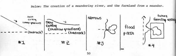
At first the river cut deeply, its gradient sometimes several yards per mile. (see #1 in diagram below.) After reaching the rock bed, the river could cut only a little deeper and gradually leveled out, becoming slower and meandering. (#2) Often the river nearly doubled back on itself, with only a narrow strip of land between the two sections. (#3) This is called narrows or devil's backbones. During a flood the river would jump across the narrows, cutting a new path and abandoning the old. (#4) This is especially evident in the Gasconade River Basin, and many other Ozark rivers, as entrenched meanders are common in the Ozarks. The old path would fill with sediment and other eroded material from upstream, later to become a prime farming Valley.
[50]
Below: The creation of a meandering river, and the farmland from a meander.
The rivers are still hard at work today. Seasonal floods continually clear land on both sides, except where rock formations check the river's path. Flooded bridges and fields, the collapse of a rocky wall with its base eaten away or movement of a sand or gravel bar several hundred yards downstream attest to the river's force and continued activity. Once born, the rivers will never die, but, barring any natural disaster, Will go on to see the end of the world.

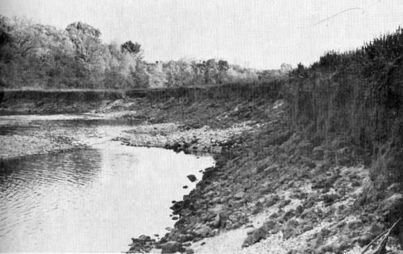
A tree stands twenty feet out in the Niangua, while usually ten feet separate the river from it.
A typical Ozark river, the Osage Fork of the Gasconade, begins from one of the high points near Marshfield, Missouri, as several small streams join together in their quest for lower levels. Still small enough for one to step across, it trickles downward, gathering more water. Three miles from its distinguishable source a small spring feeds more water into the stream, still shallow enough to ford in a car. Five, ten, even twenty miles more, the Osage Fork doubles and redoubles in size as a multitude of seeps, wet weather springs, and streams no bigger than a dribble slip silently into the river. Anywhere along this stretch, depending on the latest rainfall, a canoe or johnboat may be put in for a float. Too heavily loaded, though, and the bottom will drag in gravel on the riffles.
Winding through the countryside, feeling for the lowest spots to make its way, the river moves ever onward past farmhouses, barns and old mill sites and low water bridges that flood at every big rain. Trees, cattle and long, green corn rows stand beside the banks in silence. At thirty miles from its start a shadow plays beneath the surface, a straight line between the river banks. The foundation of an old mill dam shimmers underwater, a reminder of days long gone.
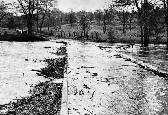
The Osage Fork rises eight feet above normal to litter the Davis Mill Bridge with logs, branches, and limbs.
[51]
Another half-dozen miles slip by, and a new steel bridge shows man's progress. A deep dark eddy waits patiently for anything to sink, hiding from sight many lost treasures on its bottom. Fallen trees and log jams block the river's path, and water detours around, over and under. Snags reach out with grasping fingers to capture any who come too near.
Another long eddy makes time stand still, but man's hand is present here. Noticed first two hundred yards away, the water disappears over a ledge. Now only a hundred yards away and finally ten, the spillway of a small weakening concrete mill dam creates a whirlpool as water thunders over, pushing the great wood and iron wheel. From twisting rapids in dense brush, the river straightens and shoots its water through the whistles of a low water bridge. Next, more rapids and another quiet eddy.
Emmense rock bluffs, first on one side and then the other, shade the sun from view. Turtles, snakes, fish, birds and ten thousand insects move unharmed, undisturbed, through water, air and on land.
Twenty miles, or thirty more, the river unfolds a new view around each bend. Under bridges, past rusted machinery, around an island, or under high wires, it moves on and on, always different, yet in ways the same, moving toward its end.
Two miles more the river moves as tranquilly as before. At sixty-eight miles from its birth and beginning, the Osage Fork quietly mingles with the Gasconade.
THE GROUNDWATER SYSTEM
Springs...the cool, clean essence of life to the river. Slippery stones glisten as clear water cascades down through rocks and fallen leaves on its way down a steep embankment to the water's edge. Another bone-chilling stream begins from a fissure in the ground, winding through gravel in its inevitable search for the river. And yet another spring feeds quietly into the river's bottom, its mouth at the base of a limestone wall. The life-blood of the Ozark Rivers, springs make up the next facet of understanding the rivers.
The Ozark rivers described here are the rivers that actually begin in the Ozarks, rather than those that flow in from outside the Ozarks. For example, even though the major portion of the Osage flows in mid-Missouri, it is not classified here as an Ozark River since it has its source on the Kansas plains outside the Ozarks. The Pomme de Terre River, a tributary of the Osage, is considered an Ozark River since it begins in the Ozarks. However, because much of the Osage flows through the Ozarks, the scenery and geography of the country is similar to the Ozark rivers. The difference is the water. The Pomme de Terre is much clearer. Where the rivers join there is a visible line between the murky and clear water.
Ozark rivers are clear for two reasons gravel and rock bottoms, and a unique seepage/drainage or spring system. The gravel and rock bottoms are the result of the rocks deposited eons earlier, and the springs the result of limestone deposits.
In the decidious forests of the Ozarks the cover of fallen leaves causes seeping water to become slightly acid. As this acidic water moves downward, it readily dissolves the limestone and dolostone underlying much of the Ozarks. Over the years the slightly acidic water forms underground reservoirs, some small, others quite large. In fact, a spring in the Ozarks may often be thought of as a water filled cave. The spring may exit the ground to create a stream on its own, enter the river along a bluff or hillside, or bubble up below the river's surface never to be seen.
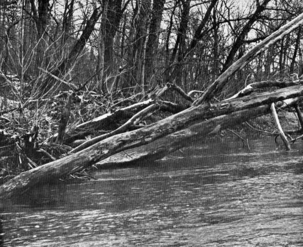
A log jam blocks the river's path, making water detour around it.
[52]
All Ozark rivers are naturally clear, but the degree of clearness between two rivers may vary depending on the drainage basin of each, whether it is agricultural, developed town or city, forest or grassland. A heavily forested area will be inherently clearer than an area with exposed soil. In addition, flood waters will erode soil into the river causing temporary murkiness, while at normal levels the soil will remain untouched.
The clearness is especially evident when compared to the plains rivers flowing into the Ozarks out of the Kansas plains, such as the Osage River, which is somewhat muddy and slower moving. The difference lies in the fact that the plains rivers receive close to their total flow from surface run-off as opposed to subsurface run-off in the Ozark rivers. The land make-up in the plains is either clay and clay-soil, which allows only surface drainage, or deep soil, which causes water reaching the river to be muddy. The mud banks and bottoms add to muddy conditions. Also, because the plains rivers depend almost totally on surface water for their flow, the rivers nearly dry up during drought conditions.
Ozark rivers, on the other hand, receive nearly eighty-five percent of their total flow from the groundwater system. Because of this, the Ozark rivers' flow is far more uniform, flowing the year around, although many small tributary streams go dry in the summer. During the rainy periods, the springs build up quite a supply of water enabling their flow to last all summer. Vegetation in the shallow soil common to the Ozarks prevents the soil from muddying the water (there isn't as much to make mud of), and both gravel and sand provide an easy path to travel in as well as serving somewhat as a filter.
The Ozark rivers are also cooler than the surrounding rivers, since groundwater assumes a temperature about two degrees above the mean annual temperature for a region. For this reason, Ozark rivers maintain a temperature of about fifty-seven or fifty-eight degrees, ideally cool for swimming on a hot summer day.
THE ECOLOGICAL STORY
Left on their own, the rivers would continue much as they always have--widening, deepening, cutting new channels and leaving behind old valleys. The ecological system of life and death around the river lies in a delicate--but positive balance, until man enters the scene.
Several hundred years ago, before the white man pushed into this region, a small population of Indians lived along the springs and rivers in a peaceful co-exis-tence with nature. Later trappers and traders moved into the wilderness in search of fur for the St. Louis center. Neither had much effect on the river, but the trappers were responsible for opening the land to those who would change it.
Lead and iron mining and lumbering of virgin forests for products such as oak railroad ties and walnut wood solved a need elsewhere, but often polluted and changed the character of the surrounding land. Available commerce brought people to the land that seemed so clean that nothing could defile it. Simple carelessness and economy made polluting the land more inticing than keeping it clean. Rivers and creeks about large towns and cities now often bear the mark of many years of abuse, such as Wilson's Creek south of Springfield.
In more recent years agriculture has had its effects on the river. During the period of the first settlement farmers took advantage of the rich bottom lands created earlier. Some, but not drastic, damage was done to the river system, for without large machinery, it might take a lifetime for one man to clear forty acres. Today spraying and bulldozing timber has rapidly reduced the forest cover with harmful results to the water system.
A nearby water table becomes muddy since the vegetation holding the soil has been cleared away. Without a cover crop to protect soil, heavy rains wash tons of the thin precious topsoil downstream, muddying the river and making the land almost useless. Since without the forest cover to hold it back so it will enter the underground water system, more rainfall runs into the river as surface water. Chemical spray overruns and fertilizers by their very nature are poisonous to aquatic animals and other animals nearby.
[53]

The rivers of the Ozarks beginning from three major high points, run north to the Missouri River or south to the Arkansas River, eventually feeding into the Mississippi River.
[54]
Heavy cattle use from overgrazing river pasture has two effects--beaten down cow paths become gullies for rainwater, and an overabundance of nitrogen from their manure leaches into the water. Nitrogen, and some phosphates, start the river plants in a race to outgrow themselves, choking the river with algae which finally leave backwashes and eddies with a stagnant, rotten scum over the surface. One isolated occurrence is relatively harmless, but constant practice is fatal.
Once thought to be the cleanest, purest water around, the Ozark springs now face contamination from sewage and dumps. Sinkholes have been used--almost as a ritual--as dumps for trash. Water draining into sinkholes becomes contaminated, in turn polluting the underground water which becomes springs. Sewage from cities, septic tanks or feedlots makes its way to the river as well with the same disastrous effects. Because of the porous nature of limestone, and the speed with which water moves underground, the pollution is not all filtered out.
The natural setting along the river... dark, ominous bluffs, gravel and sand bars, lily pads floating in a quiet cove, snags and driftwood scattered about on the river, gnarled, intertwining tree roots on the banks, springs bubbling, splashing into the river and majestic sycamores reaching toward the sky all make the river worth floating.
But people floating, or just being along the river, sometimes ruin the enjoyment for others. Discarded beer cans and bottles not only spoil the view, but create a danger all their own. Many farmers complain of animals cutting hooves on broken bottles, or even eating trash accidentally, making veterinary care necessary. A partially rusted can or broken bottle may pierce through shoes or slice open a hand, and doctors are few and far between on the river. An old rusted car, deserted and unclaimed, lies in a gully as an eyesore and a danger to anyone near it. Plastic, glass and aluminum will outlast us all by several lifetimes, an ugly spot on the river.
Man has the technology to move the land's contours to fit his wants and needs and to use the natural resources present. The effects of dredging for gravel and sand on the river is negligible unless carried to extremes. Gravel is constantly being moved downstream anyway, so if only small amounts of gravel are removed, it will be replaced by gravel and sand from upstream. Stripping a bank down to the soil, however, leaves the bank open to heavy erosion. A flood will drag as many tons of soil or more back into the river to match the gravel taken out.
Tapping the water table with wells for home and municipal supplies may have the same consequences. As long as the water taken out does not exceed the water replaced by rainfall, everything is fine.
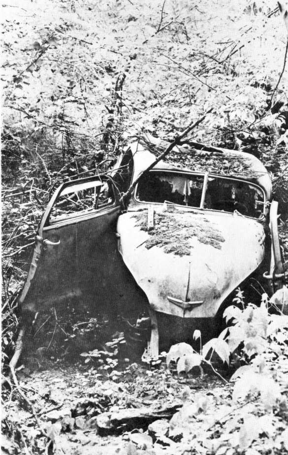
A gully becomes the graveyard for a ghost of civilization.
[55]
Using more than is replaced results in lowering water tables, drying up springs and other problems as serious as land shifting because of vacant space underground. All this affects the flow of rivers.
Damming rivers is another example of man using natural resources. Seventy-five or a hundred years ago, men dammed rivers to back up and divert the river's course to power waterwheels in mills. When gasoline engines made waterpower obsolete, and better transportation made a trip into town easy, the mills and mill dams became deserted relics. No real change was made in the river and it usually washed away the dams with time and effort. Even those few small concrete dams still standing, like Orla Mill, present no real change or danger to the river's environment.
But the huge dams built today are quite a different matter, completely changing the environment, causing us to wonder if the need to dam the rivers is real or imagined. There are currently about a dozen dams operating in the Ozarks with dams scheduled to be built on several other rivers. There is no question that building dams drastically affects the river. Since modern dams cause such a change, it is important to understand the reasons behind their construction.
Dams are built for three different purposes--hydroelectric power, flood control and recreation.
To produce hydroelectric power with a dam, the reservoir must be filled to the brim' in spring. Since no one is ever sure when rains will fall, the reservoir must be filled at the first opportunity. Rain which falls after the lake is filled must go over the spillway, since the lake is already too full to hold any more water. Then, with a full body of water, the lake is gradually drained at a steady rate to push the turbines. If no additional rain falls, the lake may turn into a sprawling mud flat useless to anyone.
For flood control the situation is just reversed. In order to give the maximum amount of space for holding floodwaters, before the rains fall nearly all water is drained from the lake, creating a mud flat. When a flood occurs, the lake in this state can hold the excess water to avoid downstream flooding. Then, as soon as the flood subsides, the water is again released as quickly as possible to allow room to hold the next flood. Since it is impossible to know when the next flood will be, the water level must always be kept low. After an extended dry period, there is another mud flat. In essence, man's solution to periodic floods downstream is to create periodic or permanent floods upstream.

[[56]
For recreational purposes, the water level of the lake cannot be too high or too low, nor can it fluctuate much. Instead, it must be at a 'usable' level. Because of the expensive development along a lake, floodwaters cannot be held back, but must be allowed to continue downstream--hence no flood control. The water cannot be allowed to get too low since shallow water or mud flats are useless for water sports--hence no electrical generation.
It is obvious, then, that the three uses are not compatible. It is true that some electricity can be generated during the flood season on flood control dams, and that some flooding can be prevented on hydroelectric sites, but only until the lake is full. Neither can work with full potential on recreational dams, as recreation requires a stable 'middle. So the multi-purpose dam is a fallacy. Dams can Work effectively only for one purpose.
The dam is also responsible for major changes in the river's environment. By nature, the erosion upstream replaces soil Lost downstream. A dam stops soil movement, preventing the replacement immediately downstream. This creates an artifical or dead environment below the dam. Also, the soil collecting in a resevoir builds until after a period of time, the reservoir becomes silted up and useless. Ths may take from thirty to forty years for a very muddy river or 150 to 200 years for a fairly clear river. This is not yet a problem in the Ozarks, but it may well be very soon. It is a fact that man can build a lake for his use. But can he build that river back from a lake? We may soon find it necessary to try.
As with all things, there are positive aspects to dams. In many cases hydroelectric dams have brought electricity to people who didn't even know what electricity was. Increased revenue for city and state are a result of tourism. Flooding is partly controlled in agricultural areas and towns with flood control dam sites. But do these temporary economic advantages outweigh the possible future consequences?
The pleasures of floating down a wild Ozark river, fishing in quiet coves and eddies, feeling the warmth of the sun, or enjoying the shade of a tree, shooting fast rapids and even dumping the canoe, swimmimg undistrubed except for the birds--all of this can in no way be compared by this author to paddling around in an overgrown pond.
It would have been impossible to write this story without help from the following: Clayton H. Johnson, University of Missouri, Columbia, Jerry D. Vineyard, Missouri Department of Natural Resources, Russel I. Gerlach, Southwest Missouri State University, Cent Boner, Arkansas State Parks, and especially George A. Kestrel, Missouri State Parks.
The rivers cannot be aptly described in one picture, for each scene is totally different. Nor can they be described in one story alone. This begins a series of stories, each different, but in ways the same.
[57]
Copyright © 1981 BITTERSWEET, INC.
Next Article | Table of Contents | Other Issues
