
Volume 1, Number 12 - Summer 1964
INDIAN CAMPSITES IN TANEY COUNTY
By Clyde W. Boulson
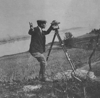
During September of 1934, I was asked by the Missouri Archaeological Department of the University of Missouri to make a survey locating campsites once occupied by the Indians in Taney County.
Assisting me were my son, Chas. E. Boulson, and Mr. Gene Walker. We were required to draw a map showing the sections in which these camps were located, and this information was sent to the Archaeological Department.
Most of the sites we investigated were located on terraces at no great distance from the banks of the streams and, as we were limited for time, we made no excavations at these sites.
In referring to the diary which I kept at the time the survey was made, I find the following:
Sept. 5th, 1934. Weather warm, sky clear. Gene Walker, Charles and I drove to the Luther Pinkley farm located in Sec. 34, T 22, R 22. On a terrace where Jakes Branch enters Long Creek, we found quite a number of flint arrowheads, rubbing stones, flint knives. Probably a large camp, possibly a village occupied this site for the location was ideal. We crossed Long Creek and worked south along the west side of the creek. There were several small fields where tobacco was cultivated, and in these fields a few artifacts were found. These were flint hoes, and as these fields were not located on terraces and were subject to flooding this land may have been cultivated by the Indians.
Sept. 7th, 1934. Weather warm and skies clear. This day we drove to Oasis. Here we met a Mr. Mahnkey who directed us to Mr. Youngblood who lived west of Oasis. Youngblood, who was an early settler, told us Indians formerly had a village at, or near, the mouth of Brush Creek. Walker and I investigated the area in the vicinity of this creek and we found several sites along the creek and at the mouth of the creek. There were not enough artifacts found here to indicate large camps. In a field on the east side of Long Creek and opposite the mouth of Brush Creek, we found many artifacts, and on the hill above this field we found flint scrapers and rubbing stones, also broken arrowheads. The locality described above is in Section 15 and, from the number of artifacts found, there must have been a large Indian village located at this place.
[16]
Before his retirement Clyde W. Boulson, Branson, was a civil engineer and engineering draftsman at Fort Leonard Wood. He has been interested in archaeology since boyhood, and was able to follow that interest as his work took him to Texas, Kansas, Colorado, and Missouri. Part of his large collection of Indian arrowheads is at present on loan exhibit at The School of the Ozarks Museum.
The remainder of the week we worked south along Long Creek as far as the Arkansas State Line. We found indications of Indian occupancy in most of the fields we investigated; however, none of these sites were as large as the one of the Luther Pinkley farm. All of the area described is now covered by the waters of Table Rock Lake.
Sept. 10th, 1934. Weather warm, sky clear. We drove this day to Swan Creek and in the N.E. 1/4 of the S.E. 1/4 of Sec. 28, T 23, R 20 we found scattered artifacts. Near the center of the S.F. 1/4 was a field. We had been informed that this field had been cultivated by the Indians and later by the early settlers. Altogether this field probably had been in use over 100 years. We found quite a few flint artifacts.
Sept. 11th, 1934. I found a Folsom Point this day in a meadow on the west side of Long Creek close to the Arkansas State Line.
Sept. 15th, 1934. Rain, cool. This day we investigated an Indian camp site that had been located east of (old) Forsyth. This site was large in area and we found broken pottery as well as flint artifacts at this site. Also on the south side of White River and east of the river bridge was another site. This was located on a terrace and here we found artifacts, most of which were broken.
Sept. 18th, 1934. Clouds but clear ingat8 A.M. Drove this day to a location south of Hollister. We had been told that several small mounds could be found northeast of the junction of Highway 65 and Highway 86 near Cedar Springs School House. Investigating
[17]
this area, we found several small mounds scattered among the cedars. These mounds were approx. 20 feet in dia. and from 2 to 4 feet high. I am doubtful if these are Indian mounds.Sept. 20th, 1934. Clear and warm, beautiful day. This day was spent near the mouth of Fall Creek. Leaving Branson, we went into the White River bottomland across from the School of the Ozarks. This was a bad drive as we managed to stray off the main highway and onto a mean road that went nowhere. From the mouth of Fall Creek, we worked south and found signs of Indian occupancy in most all of the cleared fields. Working up Fall Creek, we found a few artifacts; in fact this whole area must have been occupied by the Indians at various times.
(Note: As this survey was made 30 years ago, the conditions of the roads have changed materially, for the highways are blacktopped now.)
Sept. 22nd, 1934. Fog, drizzle, clearing in the afternoon. We went to Forsyth this day and from there we drove up Swan Creek. In a meadow on this creek and several miles above Forsyth, we found quite a number of small mounds. Mr. John Neihardt, who accompanied us, told us that these mounds may have been the caved-in remains of Indian lodges.
Sept. 26th, 1934. We camped on Beaver Creek as it was too far from Hollister to the area in which we were now working. From this camp Gene Walker and Charles Boulson worked the White River valley as far as the Arkansas State Line.
Practically every bottom land had indications of Indian occupancy. As the major part of this area is now covered by the water of Bull Shoals Lake, it is now impossible to find these locations.
Oct. 1st, 1934. Beautiful autumn day, clear and cool. Drove to Forsyth in the morning. Walker and Andy Youngblood and Charles accompanied me. Returning towards Hollister, we made a detour and drove south where we found some small mounds south of Gobbler Knob School. These mounds were in the cedar glades and we are doubtful if these are Indian mounds as they may be the result of erosion.
Separating from the rest of the party, I walked across the country southwest towards Turkey Creek. I came to a small stream that flowed west through a meadow. In this meadow I found a little mound near the bank of the stream. Later we excavated in this mound and, at the former ground level, found a layer of what appeared to be ashes and a flint artifact.
The work came to an end October 15, 1934. From early in September to the above date, we had worked an area adjacent to the White River from Long
[18]
Creek east and southeast to the Arkansas State Line. As we were rushed for time, I am sure we probably missed other sites. In this article I have not mentioned all of the sites investigated; however, I have noted the principal ones that were found.Several years ago, the Archaeological Department of the state university conducted a field survey in the area that eventually was covered by the waters of Table Rock Lake. Their findings were very interesting, for their discoveries brought to light the culture of the prehistoric Indians.
Mr. Elmo Ingenthron has written a very interesting article which appeared in the Summer 1963 issue of the White River Valley Historical Quarterly. In the article he mentions the different Indian tribes who at various times had inhabited the White River region. He wrote there were three abandoned Osage village sites on Swan Creek that were noted by the early explorer Henry Rowe Schoolcraft in 1819. These must have been the small mounds located in the meadow on Swan Creek that we found on our survey September 22, 1934.
For those who like to hunt Indian relics, there are a few places left in the White River area where artifacts might be found. I imagine that after you have tramped through the fields and found a few arrowheads the memories that will remain with you will be that of far blue horizons, cloud shadows drifting across the glades, and the beauty of the country.
[19]
This volume: Next Article | Table of Contents | Other Issues
Other Volumes | Keyword Search | White River Valley Quarterly Home | Local History Home
Copyright © White River Valley Historical Quarterly
