
Volume 2, Number 12 - Summer/Fall 1967
Ozark and Vicinity in the Nineteenth Century
by William Neville Collier
(Continued from the Spring of 1967 Quarterly)
It was somewhere about the year 1890 that a suave and urbane young man arrived in Ozark, claiming to represent the ball club at Marionville, Missouri, and his business was to try to arrange a game between that club and the Ozark team for a stake of $100, a large pot in those days, when playing was generally done merely for sport. Negotiations lagged for a few days, and finally the man from Marionville offered the unheard of inducement that his team would use but six men in the game, the Ozark team to play with the regular nine. That was too good to pass up, it being considered impossible by the Ozarkites that any six men could beat the local club, and on the day of the game money was freely wagered by the Ozark sporting fraternity on the outcome, there, being plenty of Marionville money to cover all bets.
The game was played in Ozark and attracted much interest on account of the unusual feature of six men playing against nine, and because of the comparatively large amount of money at stake. The six men were not thought to have a chance to win, but they did it easily enough, although it was not quite fair—their pitcher used a curve ball and the Ozark boys had never seen one before! And the six men were not from Marionville, either.
After that debacle the team was reorganized and the costly but valuable information concerning curve ball pitching was taken to heart and thereafter used to advantage. It was the especial pride of the Ozark Club that it could generally beat any team that Springfield could muster. The club reached its top form in the decade when it beat a team from Saint Louis in each of a four-game series played on the Ozark grounds. At about this time, at a game played in Springfield, a writer on a paper there—H. Clay Neville—called the visiting team the "Ozark Invincibles", and the name stuck.
It would not be possible to name all the players that belonged to the club in the years 1890-1900, as there were constant changes as new players took the places of those dropping out. But the outstanding member of the club through these years, a man who did more than anyone else to foster interest in the sport and maintain a winning team was its captain and ace pitcher, James F. Adams. To his ability, and his devotion to the game was due the high amateur rank of the "Invincibles".
From the date of the county’s organization in 1859 up to about the year 1894, county offices had been filled by the following persons:
SHERIFFS: John Collins, William Friend, J. J. C. Brazeale, M. L. Edwards, John Charles, A. C. Cram, J. C. Woody, William Gardner, Z. A. Johnson, C. P. Gibson and D. F. Thompson.
REPRESENTATIVES: H. P. Greene, William Lawing, T. W. Allred, John Hornbeak, J. J. Gideon, D. W. Pope, B. F. Plummer, J. B. McHenry, J. J. Bruton.
COUNTY & CIRCUIT CLERK: John McD. Pettyjohn, James R. Bell, T. J. Gideon, John C. Rogers.
In 1886 the two offices were separated Circuit Clerks were W. M. Wade and M. V. Gideon. County Clerk was James F. Adams, elected in 1886 and 1890.
ASSESSORS: Alvor Davidson, J. P. Roberts, D. M. Cowan, John McD. Pettyjohn, Archibald Walker, William Thompson, George W. Ray, John C. Rogers, William Norman, W. J. Wray, H. R. Elkins, W. W. Gideon, John H. Billingsley, Isaac Tyndall.
PROSECUTING ATTORNEYS: John A. Williams, L. S. Clements, J. J. Gideon, W. H. Pollard, J. J. Gideon (again, A. Harrington, G. A. Watson, W. A. Long.)
TREASURERS: L. P. Ayres, John R. Weaver, T.D. Pettyjohn, (elected 1864 and again in 1866 but then resigned and John R. Weaver was appointed), P. T. Ball elected 1868 but the office was vacated before the end of the term and John R. Weaver was again appointed, and was elected in 1870. The next was A. T. Yoachum, followed by John R. Weaver, G. T. B. Perry, John P. Collier, George W. Taylor, James W. Collins and W. K. Johnson.
JUDGE OF PROBATE: This office was established by a special act of the legislature in 1866, and John Redfern was the first incumbent. In 1870 E. H. Cornog was elected but soon resigned and J. W. Robertson elected as his successor, who also resigned and Mathew Chapman was appointed. In 1872 D. M. Cowan was elected; in 1874 Stanford Chapman was elected but resigned before discharging any duties of that office, and J. M. Forrester was appointed. He was followed by D. M.
[20]
Cowan, W. W. Aven, John A. Williams and John P Collier.
It is scarcely possible to write about Ozark and Christian county with no mention of Springfield. In early days to the people of Ozark it was "town," a place of importance in every respect, a place to visit whenever possible, to walk the brick sidewalks; stroll around the square, view the many things on display in the stores’ windows, watch the horse-drawn street cars, marvel at the brilliant gas lights and enjoy for awhile the exhilarating consciousness of metropolitan life.
Greene county was organized in 1833 and Springfield made the county seat. Location of the United States Land Office gave the place its start, aided by a naturally good location for a town. The railroad from Saint Louis, the first train which arrived April 21, 1870, and later the railroad from Kansas City, gave the city a commercial momentum that carried it on to its present supremacy in Southwestern Missouri. A post-office was established in Springfield in 1834 with J. P. Campbell as Postmaster. In 1835 Daniel Gray was county assessor. In 1837 the Ozark Standard was started, the first paper in that town. Gas lights were first used in 1874, electric lights in 1884, electrified street cars in 1890.
William Fullbright built the first mill in Greene county, at the Fullbright Spring, near Springfield. A still-house was operated in connection with the mill and its product was as universally consumed, and largely considered as necessary, as was the product of the mill. Whiskey was in every cabin, and both young and old drank without restraint. Even the pioneer preacher did not hold back when the jug was passed around. Three good drains a day was considered about right, although at Christmas, house-raisings and weddings this limit was not adhered to. At the still-house a bushel of corn could be exchanged for a gallon of whiskey.
Springfield was about as far from home as the ordinary run of citizens ever ventured. There was little need to go farther—the town furnished all necessary facilities whether for buying or selling. Ozarkites with cash money to spend often went to Springfield to do their buying. When not so flush they bought from stores at home—on credit. Nor was the city lacking in diversions for its transient population. Here was held the annual County Fair, a week of exciting sight-seeing; here the circus made its regular visits, and occasional shows by traveling troupers, concerts, lectures and good church services catered to those to whom such things appealed.
Nor was entertainment lacking for a visitor that did not care for those things. If his notion of diversion was something else; something pitched on a lower cultural plane, he easily could be suited. Here was the glaring lights and raucous noises of prominently located saloons, while hard-by and not so prominent were quieter places where, if a man thought he was lucky could soon find out whether he was or not. And not far away on dimly lighted streets could be found stairways leading up to regions of exciting adventures or worse. It was a place, in short, where a man, held strictly to account in his home burg by the force of public opinion, could mix with the throng and assume an anonymity sufficient for any purpose. And the subsequent telling in the barber shop at home of his escapades-often with broad hints of incidents (generally fictitious) that would not do to tell, was not the least of the satisfactions derived from his trip to the city.
The Metropolitan Hotel was, in a way, a sort of social center in Springfield, and to be seen in the "Met" gave to the Ozarkite a sense of satisfaction not to be attained in his home town. To lounge in one of the many chairs provided by the hotel for its guests—in summer placed outside under the large marquise—and perhaps wave nonchalantly at a passing acquaintance was a sure mark of sophistication, while to actually "put up" at the hotel overnight,—at a cost of one dollar and a half for a room and two meals—was a spending orgy unjustifiable from any standpoint by the average Ozarkite, who could patronize a less pretentious hostelry for just one-half that amount, and could even better that some by a bunk in a Campbell Street wagon-yard.
It was inevitable that Ozark would continuously lose citizens to its big neighbor through their moving their residences to a place where opportunities for getting on were greater arid living conditions thought to be more attractive. Young men, particularly, were not content to remain in Ozark, for there was little to look forward to and many of them made Springfield their home, so that in a social way, at least, the two places became somewhat closely associated in the course of time. So much so, indeed, that an Ozarkite old-timer came to feel about as much at home in Springfield as he did in Ozark.
In the twentieth century came good highways, automobiles, moving pictures, the radio, and wider distribution of electrical power. These made life more easy and enjoyable, but they robbed the small towns of their former individualism. Today life in those places seems to lack the zest and gusto of the pre-sewer age. Or maybe it is just the writer growing old.
THE VALLIERE LAND GRANT
The land title records of Christian County, and probably those of other counties in southwestern Missouri, contain innumerable deeds from grantors who claimed ownership under a
[21]
Spanish grant of a vast body of land in southwestern Missouri and northwestern Arkansas. The sales represented by these deeds were the cause of vexation and loss in many cases where the buyers had accepted the deeds in good faith. These buyers were generally non-residents of the state, or at least of the locality; persons who knew little about land transfers, it may be inferred, and learning about their misfortune only after arriving in the county to take possession of their purchase. So far as the writer knows the history of this old grant has never been written, and it is believed that a short story concerning the matter may be of interest.
On the 11th of June, 1793, at New Orleans, the then governor-general of Louisiana, Baron De Carondelet, made an order of survey of a tract of land situated on White River, and on each side thereof, within the then Province of Louisiana, but what now is the states of Missouri and Arkansas, in favor of Don Joseph Valliere. This order was executed by the surveyor-general of the Province, Don Carlos Trudeau, who, on October 24, 1793, made a return certifying that the land described in the order of survey had been surveyed. "All of which", he goes on to say, "is fully demonstrated in the figurative plan which precedes, in which is marked the dimensions, limits, trees, and posts serving as artificial or natural boundaries." The formal grant, dated December 22, 1793, was made by the Baron De Carondelet, and is in the following words:
"For the benefit of the public, and for the greater encouragement of agriculture and industry of the country, I have judged it expedient to fake various steps for surveying and granting the royal lands in the province. Therefore, I grant to Don Joseph Valliere, Captain of the regiment stationed in Louisiana, a portion of the land in the jurisdiction of Arkansas, situated on both banks of the Rio Blanco, ten leagues on both sides, beginning at the origin of the most western branch of the Rio Blanco, and running southwest ten leagues, descending from thence on the south by parallel lines with the Rio Blanco at the distance of ten leagues until it intersects the Rio Cibolus at a point ten leagues in direct line with Rio Blanco, from thence descending the Rio Cibolus to its confluence with the Rio Blanco, following this as far as the mouth of the Rio Norte Grande, up the same to a point ten leagues in a direct line from its mouth, from thence ascending the Rio Blanco to the north in a westerly direction, ten leagues from the same as far as its source, which will be better seen on the figurative plan, made by my order, by the Surveyor-General Don Carlos Trudeau, of the Province, 24th October, last; (It being impossible for the Surveyor-General to make an actual survey at this time) and in virtue of my order in June of the current year, by which I made him a grant, and ordered the Surveyor-General to put him in possession in the usual form."
"In consequence of the power which has been conferred on me by our Lord the King (God preserve) I grant in his royal name to the said Don Joseph Valliere, Captain of the Regiment of Infantry in Louisiana, the said portion of land described above, in order that he may dispose of it, he and his legitimate successors as property belonging to him. Done in New Orleans 22nd December, 1793."
The Rio Blanco is White River; Rio Cibolus is Buffalo River, and Rio Norte Grande is the North Fork of White River. A Spanish league of that time was approximately three miles. Nothing is known of the "figurative plan" mentioned in the grant.
It will be noted that the Surveyor-General, in his return dated October 24, 1793, said that a survey of the tract had been made. But in the grant itself, made about two months later, the Governor-General stated, in effect, that no survey had been made. And while the figurative plan had been drawn by his order, it could not have been from an actual survey of the land. It is thus a fair assumption that no survey was made. The land lay in the heart of a country held by hostile Indians, an unexplored region excepting the lower reaches of White River, and simply a trip to the headwaters of that stream would have entailed much time and hardship and probably danger to an exploring party.
Don Joseph Valliere died in 1799, and there is no record of his having been put in possession of the land, or making any settlement thereon. And seemingly nothing was done by Valliere’s heirs to claim the land until a long time after his death.
On October 1, 1800, the Spanish government ceded the province of Louisiana to France, and the latter to the United States on April 30, 1803. Possession was taken of the lower part at New Orleans December 20, 1803, and at Saint Louis of the upper part March 9, 1804. Little time was lost by congress in legislating concerning the territory acquired, and many laws were enacted from 1804 to 1825 having to do with lands in the former province that were held under French and Spanish grants. One such act, dated March 26, 1804, provides, among other things, as follows: "And be it further enacted, that all grants for lands within the territory ceded by the French republic to the United States by the treaty of 30th of April 1803,
[22]
the title whereof was, at the date of the treaty of St. Ildefonso, in the crown, government or nation of Spain, and every act and proceeding subsequent thereto, of whatsoever nature, toward the obtaining of any grant, title or claim to such lands, and under whatsoever authority transacted, or pretended, be at the same are hereby declared to be null and void, and of no effect in law or equity. Provided, nevertheless, that anything in this section contained shall not be construed to make null and void any bona fide grant, made agreeably to the laws, usages and customs of the Spanish government to an actual settler on the lands so granted for himself and his wife and family if made prior to December 20, 1803. And provided further, that such shall not secure to the grantee more than one square mile of land."
Subsequent laws enlarged the amount of land that could be held by bona fide settlers under such grants, in some instances naming one square league as the maximum, and in legislation enacted in the 1830’s mention is made of confirmation of titles to tracts exceeding one square league. But in no instance, apparently, did a law modify the requirement that the claimant must be an actual settler on the land. Most of the laws enacted between the years 1804 and 1826 which had to do with French and Spanish grants were for the purpose of setting up tribunals and prescribing methods to be followed by claimants and by government officials in handling claims and investigating titles. It does not appear that the Valliere heirs paid any attention to such laws. At least there is no record of their having presented a petition in connection with the grant, or making any other effort to establish their rights, until long after Valliere’s death.
In the year 1841, however, a man by name Creed Taylor obtained from the Valliere heirs a Power of Attorney authorizing him to sell or otherwise dispose of the land, or any part of it. This document, dated June 5th of the year mentioned, is quite lengthy. It recites in detail the genealogical history of the Valliere family from the date of death of Don Joseph. It appears that he left four children, and at the date of signing the Power of Attorney the heirs numbered twenty-one. Creed Taylor being one—the husband of a granddaughter of Don Joseph. Several of the heirs were minors, and of those signing for themselves five signed by mark. The instrument goes on to say, "Now the said heirs and legal descendants of Don Joseph, not having been able heretofore to establish their right to certain lands in Louisiana, granted by the Spanish Government to him in his lifetime, and not having been able to gain possession of the same in consequence of the loss, or removal of certain records of said government from Louisiana about the period Louisiana was ceded to the United States." Here is recited the heirs’ names and the usual form of Power of Attorney to dispose of: ‘Two grants of land in that part of the Province of Louisiana called the Attakapas, one containing about 1600 arpens, both situated in the Bayou Teche, now in the Parish of St. Marys; also one other grant of land (giving its description) on White River." The instrument was acknowledged before an official in Jefferson County, Arkansas, June 8, 1841.
Apparently Taylor lost little time in exercising his authority. In a deed from him dated June 23 1841, an undivided one-half interest in the White River tract was transferred to John Wilson for a consideration of thirty-thousand dollars. It is probable that this money, or at least part of it, was used to get legal opinions concerning the heirs’ title to the property. It would seem, however, that at that late date they scarcely could hope to be put in actual possession of the land. Perhaps the intent was to try for a cash settlement from the Government.
Taylor was no miser when it came to spending money for legal advice; he went to the top of the profession for opinions. Among other attorneys employed were Daniel Webster and Rufus Choate. These men, together with David B. Ogden, Thomas
A. Emmett, James Kent, J. Blunt and John Sergeant, in separate documents dated in February, 1843, each rendered opinions to the effect that the Valliere heirs had a valid title to the land. These opinions were based on the terms of the treaty between the United States and France wherein the property rights of persons were protected in those cases where grants of land, such as they believed the one in question to be, had been completed prior to the date of the treaty, and that the Congress of the United States had no jurisdiction in any legislation concerning titles to the grants.
Another of the attorneys was Ben F. Butler. His opinion, covering ten closely printed pages, goes into the question at length. All of the laws that had been passed by Congress affecting lands in the former territory of Louisiana were enumerated, and those particularly applicable to the case were discussed. Butler seemed to think as the other attorneys did concerning the rights of the claimants under the treaty. But he also seemed to feel, though the matter was not specifically mentioned, that the heirs should not have waited until after the many acts of Congress had been passed and were in process of being carried out to prosecute their claim. He felt that in the sale by the government of land within the limits of the grant, which had been proceeding for several years past, the purchasers had acquired titles
[23]
that could not be ignored.
One of the laws discussed in some detail by Mr. Butler was that of May 26, 1824, wherein claimants of titles to lands covered by grants from the Spanish or French governments were given two years from the passage of the law in which to present their petitions to tribunals specified in the act for the purpose of having the claims examined and a determination made of titles. Failure to present a petition, or claim, within the two year period named would forever bar any subsequent claim. This law applied exclusively to lands in the two states of Missouri and Arkansas. Of its fifteen sections, thirteen applied to Missouri alone.
No direct, clean-cut opinion was given by Mr. Butler as to whether the claimants under the Valliere grant had a valid title. Although he, like the other attorneys, doubted the authority of Congress to pass laws concerning titles to lands under the grant, yet he took cognizance of such laws, remarked that they are not entirely consistent in their several provisions, and went on to say: "I find great difficulty, notwithstanding much time and reflection given to the point, in coming to a conclusion entirely satisfactory to myself." This with respect to the act of 1824, herein before mentioned. He says further: "But whether it belongs to the Congress of the United States, under our constitution, after the establishment of the state government of Missouri, to pass laws barring perfect titles to land in the state, derived from the Spanish government, and protected by the treaty and the general principles of the laws of nations, in case of their not being presented within a certain time to be fixed by Congress, is another and a very different question." And, ‘I will merely say that I think there are very strong, if not insuperable objections to the existence of any such power; and that I would by no means recommend an acquiescence in the provision in question until their validity shall have been distinctly adjudged and established by the Supreme Court of the United States."
Mr. Butler’s advice to the claimants maybe inferred from the following statement: "A single action against the occupancy of the tract included in the grant to Vallerie, holding under letters patent from the United States, would present all the questions in the case; and if brought in favor of such of his heirs as are citizens of some other state than Missouri, in the Circuit Court of the United States where it would receive a determination which would apply to the whole tract." Perhaps as a result of that advice the case was taken to court. But it does not appear that it took the form of action against an occupant of the land, as Mr. Butler advised should be done.
In the year 1847 the heirs (Francois Valliere and others) through their attorneys presented a petition to the United States District Court for Arkansas asking to be given title to the land. The court record recites the grant by Governor-General Carondelet and statements by the Surveyor-General, these documents having been a part of the claimants petition. The petitioners seemingly offered no evidence that Valliere or any of his heirs ever had taken possession of the land, or of any part of it, or made a settlement thereon.
"No claim of title was presented by his heirs" so the decision continues, "to the Commissioners appointed by the act of Congress of March 2,1805 or the subsequent laws on the subject of French and Spanish grants in the province of Louisiana, nor is the grant mentioned in any of the reports made by any of these commissioners to the Treasury Department; nor does it appear to have been set up or brought to the notice of any tribunal, or to the notice of the government until now. The first time it appears to have been brought to notice in any form was, that in 1844, a pamphlet was published in New York by Jared W. Bell containing copies of what purported to be the original title papers and translations, as above set forth, and legal opinions by Daniel Webster, Rufus Choate, A. P. Upshur, David B. Ogden, Thomas Addis Emmett, James Kent, J. Blunt, John Sergeant and B. F. Butler, pronouncing the claim valid and the title complete."
"But the fact that a claim of such magnitude, and thus apparently formal and regular as to muniments of title, should be allowed to sleep for more than half a century is a strong circumstance against its validity, and on the familiar principle of lapse of time, ought to be conclusive against it."
The court record goes on to show that the claimants petition was answered by S. H. Hem-stead, District Attorney, by denial of the petition’s allegations and the validity of the claim, and by a demand for proof. The petition was dismissed on June 22, 1847, for want of prosecution, and a subsequent motion to reinstate it was over-ruled. Daniel Ringo and F. W. Trapnall appeared for petitioners.
The pamphlet mentioned by the Court was available to the writer. It is a bound book of 31 closely printed pages containing the original documents in Spanish, with their translations, together with the Power of Attorney and the opinions of a number of attorneys. The author’s name does not appear, nor is the purpose for which it was printed stated, although presumably it was for use as evidence in court.
There was one point touched on, rather superficially it would seem, by two of the attorneys. And
[24]
this was the sufficiency of the wording of the grant with respect to the tract’s boundaries. Mr. Blunt in his opinion states: "It cannot be supposed that the tract was actually surveyed at the time; and, indeed, the grant states that fact; but as the tract is definite in its terms, and is located by certain known rivers, no actual survey was necessary to make the grant valid."
In Mr. Butler’s opinion he says: "The survey and figurative plan xxx will be evidence of the legal demarcation of the tract, sufficiently definite to enable the Governor-General to make a grant which will be valid, if the tract cart be located by the description contained in the report by Surveyor-General." (Words underscored by W.N.C.) x xxx "But, as already remarked, an actual survey was not necessary to enable the Surveyor-General to make a valid grant; and, although for the want of it, there may possibly be some inaccuracies in the description, yet, as all the natural boundaries are defined by notes, there would seem to be no difficulty in giving the description (prospective?) tenants a practical location."
The "figurative plan" mentioned in the grant was drawn by the Surveyor-General by order of the Governor-General. Presumably it was a plat with boundaries conforming to the metes and bounds named in the grant; a plat made, not as a result of a survey, but from such information as the Surveyor-General possessed. No doubt it showed an enclosed area, but would be grossly in error in that its western boundary would have been nowhere near the source of the White River, a point specifically required by the grant to be on that boundary.
It is easy to believe that at the date when the grant was made the Spanish authorities in Louisiana had little knowledge of the country at the headwaters of the White River, and none whatsoever as to the "source of its most western branch." But as its lower reaches have a general northwest and south-east direction it would be logical for the Surveyor-General to conclude that the rivers source would be found in a direction north-west from a known point lower down. In fact, on an old map examined by the writer the river’s location is so shown; the source being about where now is the town of Nevada, Missouri. And the wording of the description as applied to the northern boundary of the grant conforms to this assumption. The north-east corner was fixed as a point ten leagues up the Rio Norte Grande from its mouth, and "thence ascending the Rio Blanco to the north in a westerly direction, ten leagues from the same, as far as its source."
The source of White River, or rather "the origin of the most western branch," as the grant’s description designates a point on the western boundary, apparently is somewhere in the divide separating its drainage basin from those of Grand River and the Arkansas, probably in Washington County, Arkansas. This location actually is farther south than is the area at the mouth of the North Fork. If the line of the north boundary of the grant, starting at the northeast corner (Ten leagues up the North Fork), run "north in a westerly direction, ten leagues from the same," its course would be approximately North, 55 degrees West, and the lines projection on that course would miss the source of White River by almost a hundred miles. The tract’s boundaries as set forth in the grant did not, therefore, describe an enclosed area, as there could have been no western boundary. This defect alone seemingly should have been enough to invalidate the grant.
It is only fair to say, however, that such discrepancy could have been discovered only after fairly accurate surveys had been made and the region mapped. At the time of the litigation, which was in the 1840’s, a map of the region in sufficient detail to permit a comparison of the grant’s description with the geography at the head waters of White River was not in existence.
The evidence points to there having been a bonafide grant made Valliere, made as complete as the Spanish law required, and in conformity with such information as was available to the authorities concerning the lay of the land in the tract to be granted. And it was the intent of Congress, as expressed in a decision by the Supreme Court in a somewhat similar case involving a grant in Florida, to protect the citizens of the new acquired territory in all the rights to property that they would have enjoyed had no transfer of sovereignty taken place, the decision stating, in effect, that technicalities and minor irregularities in considering titles to such grants should waive and the claimants be given benefit of any doubt.
Had Valliere’s life been spared for several years longer it is probable that he would have established his right to the grant, but as the boundaries of the tract were indefinite, as herein before mentioned, there would have had to be some reasonable adjustment as to size and location of the tract. It also is probably that Valliere’s heirs could have secured the property, or some of it, if they had been diligent in presenting their claim. But for them to have waited almost fifty years after Valliere’s death to raise the question; waited until the country in which the grant was located had been largely settled by persons holding title from the United States, was enough, as stated by the court, to defeat the claim regardless of any other consideration.
But the heirs of Valliere, or those claiming under them, were not deterred by adverse court
[25]
decisions from trying to sell the land, and seemingly they found buyers. Transfers were generally for a section or more, running up to a whole township. Grantors claimed no more title than that emanating from the grant to Valliere, it is true, but that was none at all for practical purposes, and a buyer had only a piece of paper instead of a piece of land to show for his outlay.
Early settlers in Christian County, such as those coming in the years 1822-26, could not be certain that the lands they had selected as homes could be obtained from the Government. For, although they had preemption rights as squatters, and could acquire the lands they had selected as soon as it was surveyed (about 1836), yet it was not until about 1826 that the question of ownership was settled as between the United States and the heirs of Valliere. For until the expiration of the two-year period named in the law of 1824 in which claimants under such grants could petition the court to confirm their titles, there remained the possibility of the Valliere heirs being adjudged the owners.
The account of the case tried in the District Court for Arkansas in 1847 was taken from the United States Court records. A search of the Supreme Court index of cases failed to disclose an appeal of the case. An examination was made of all acts of Congress from 1804 to 1842 that related to French and Spanish land grants in Missouri and Arkansas.
THE END
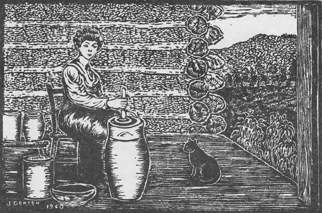
"Churning" by John Gerten
[26]
This volume: Next Article | Table of Contents | Other Issues
Other Volumes | Keyword Search | White River Valley Quarterly Home | Local History Home
Copyright © White River Valley Historical Quarterly
