 |
Vol. VIII, No. 4, 1995 |
People and Places in Buffalo River Country, 1995
By Robert Gilmore

At the top a laconic, under-stated road sign declares, "Hill." Heading down, several signs, sporting squiggles and curves and twists and loops, confirm the obvious -- this road is not straight. Trucks are commanded to use a lower gear, good advice for passenger cars as well, for I found myself riding the brakes nearly constantly as I approached the Buffalo River.
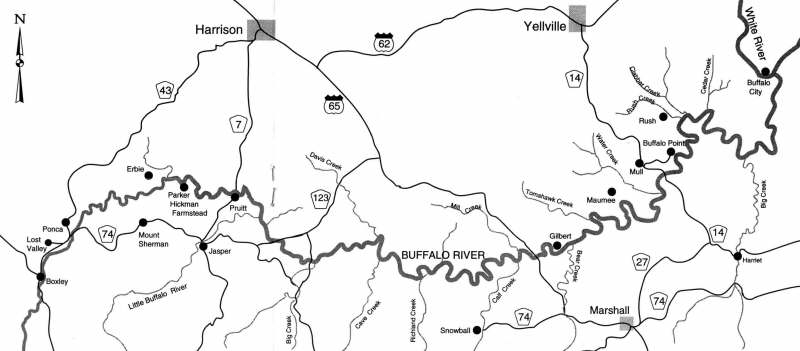
You go down to the Buffalo. Over eons it has cut itself a deep and narrow path through the Arkansas Hills on its way to join the White River. Most roads in Arkansas follow ridgetops, with an occasional dip into a valley before climbing back to the ridge. The dip into the Buffalo River valley is always a significant one, even on a major route like heavily-travelled highway 65.
For this article, I wanted to explore, not the river itself, but some of the places around the river that have been part of the rich heritage of this beautiful and rugged country. (Please note: I managed to get to the third paragraph before using the word "rugged" to describe the area. Everyone who writes about Buffalo River Country sooner or later uses the word. My computer's thesaurus lists some alternatives -- craggy, jagged, rough, stony, uneven. These words are also quite appropriate. I will probably be using one or more of them later.)
Snowball
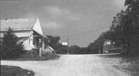
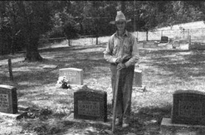
I wanted to visit Snowball. I didn't know much about it, other than it was a gateway to Richland Valley, and I had heard that most of its buildings had tin roofs. It's easy to get to Snowball. About four miles south of the river on Highway 65 you mm west on Highway 74. Tin-roofed buildings begin to show up even before you get to Snowball which is on Calf Creek. In August Calf Creek is a mere trickle, but there are many signs that it becomes a robust stream in other seasons.I wandered through the very neat, well-tended cemetery on the north edge of town. Two small gravestones caught my attention. "Infant son of J. B. and I. C. Griffin," one read. He had died in August, 1909, aged 2 months. The other stone carded a poignantly similar inscription -- "Born July 5 1910, Died July 7, 1910." The parents' grave was alongside.
Still thinking about the hurt these parents must have suffered, losing two infant children within a year, I approached an elderly gentleman tending some graves at the upper end of the small cemetery. We howdied and talked about a number of things, including how Snowball got its name. The community was originally known as Calf Creek, it seems. When the Masons built a lodge in town about 1887, they wanted to honor one of their active members, "Uncle Ben" Snow, who was also a community leader. They asked the Postal Service in Washington to rename the town "Snow Hall." Perhaps the writing in their petition was unclear, but approval came back for "Snowball," and so it has been.
[16]
My informant, I learned, was Mr. Fred Griffin, a younger brother to the two infants whose graves I had noticed earlier. He spent quite a bit of his time, he told me, caring for several Griffin graves in the cemetery, including the plot where he would be buried.
There are only a few families living in Snowball now, Mr. Griffin told me, but in earlier times it was quite a bustling place, with a hotel, seven or eight stores, a cotton gin, two grist mills, a sawmill, and a school, in addition to the Masonic hall.
I went back through the tin roofs of Snowball, and west for a way on a graveled county road, past the burned--out rock remains of the school. I would have liked to go all the way to Richland Valley -- over Rollins Mountain, through McCutcheon Gap, and the ford at Richland Creek -- but I was afraid my car didn't have the clearance needed for either the road or the ford, so I turned back.
Gilbert
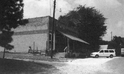
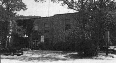
I drove back across the Buffalo on 65 and east a few miles to Gilbert, population 43. The homes of the permanent residents are neat and well-tended. Mrs. Lucille Baker and Mr. Leon Shipman have both lived in Gilbert most of their lives, and graciously invited me into their homes and shared their knowledge of the village with me.Gilbert, although right on the river, was a railroad town--a bustling commercial hub for the valley. It was formed and planned by the Missouri and North Arkansas Railroad around the turn of the century, and named for J. A. Gilbert, the railroad superintendent.
In its heyday, I learned, Gilbert boasted a big Eagle pencil factory, tie yards, cattle pens, two hotels, a cotton gin, and a number of stores. The saloon, alas, was washed away in a flood in 1915.
In the early 1920s, the population of Gilbert increased dramatically with the incursion of a millennialist sect from Illinois. The purpose of this group is described by Dwight Pitcaithley in his book, Let the River Be.
[17]
Organized in 1912, the Incoming Kingdom Missionary Unit was the creation of John A. Battenfield, a Christian Church minister who believed that he had discovered the millennial prophecies of the Bible .... [Battenfield believed] that the millennium would begin only after a worldwide war between Catholics and Protestants, and that to survive the holocaust his followers must establish faithful communities in the isolated mountainous regions of the country and attempt to restore the true church.
One of these communities was established at Gilbert. A frame church and schoolhouse and a stone building to house the printing plant were constructed. The official newspaper, The Kingdom Harbinger, was printed and distributed nationwide from Gilbert. The new church people were very industrious, and blended in quite well with the local citizens. After about 1925, however, interest in the religious experiment faded, and many of the colonists left.
A different fate might have been in store for Gilbert, had the Corps of Engineers had their way. Back in the 1950s and 60s, the Engineers were proposing a high dam to be erected across the Buffalo, just a few miles upstream from Gilbert. Had the river been dammed, I couldn't help but think that Gilbert might today be the Branson of Lake Buffalo. As it is, Gilbert is a popular put-in for those floating the Buffalo. Canoeists can buy supplies and refreshments in the old Gilbert store and post office, one of the last reminders of the earlier bustling railroad town.
Dillard's Ferry
You won't find Dillard's Ferry on the Arkansas State Highway map, nor will you find Mull. But if you drive south down highway 14, about 14 miles from Yellville, there will be a road sign proclaiming the community of Mull. Keep going, and a high bridge will take you over the Buffalo Riven Earlier in this century, you would have taken the ferry across the river, the ferry operated by J. F. (Doc) Dillard and his boys. Doc Dillard, the patriarch of "Dillard Settlement,'' oversaw a diverse empire. There was, according to the Yellville Mountain Echo, "a store, saw mill, lumber industry, grist mill, sorghum mill, and numerous other small community enterprises..." The Mountain Echo described how the area was for years isolated from the outside world, with the unbridged Buffalo on one side, "the only outlet on other sides rocky trails across steep mountains and deep canyons." Yet, the paper reported, "for more than a third of a century lumber from the Dillard saw mill went out by wagon to Yellville, Marshall, and other towns on the railroad or went by boat or raft down the Buffalo."
Mrs. Doretha Dillard Shipman is a granddaughter of Doc Dillard. She and her husband Leon live in a pleasant, shaded, rambling house not far from the Dillard Settlement acreage where she was bom and raised. "My grandparents had 14 children," she told me over cups of coffee, "and I always wanted to have 14 children, too." Did you make your goal?, I asked. "Yes", she replied, "I did. I had seven children and they each married, and there are the 14.' Those 14, and a number of grandchildren, crowd the Shipman's spacious farm house after church just about every Sunday.
Before I left, Mrs. Shipman filled up my coffee cup again and asked if I wouldn't like a hot ham sandwich. As she placed it in front of me, she said the only thing she had to make the sandwich with was a "flat biscuit." The flat biscuit turned out to be two slices of store-bought bread. It was delicious.
[18]
Buffalo Point
Just a few miles east of Mull and the Shipman's home is Buffalo Point. The area was formerly Buffalo River State Park, but was donated to the National Park Service at the time the National River was established.If you visit Buffalo Point you'll see, by the old State Park Cafe, a plaque with a moving memorial message:
THERE ARE LITTLE CORNERS OF THIS EARTH PUT ASIDE BY NATURE TO BE DISCOVERED BY AND TO BRING JOY TO LITTLE BOYS. THE LANDS OVER WHICH YOU LOOK HERE, ACROSS THIS BEAUTIFUL RIVER, ARE SUCH A CORNER; AND THE ARROWHEADS TO BE FOUND THERE, THE TINY Box CANYON WITH ITS WATERFALL AND THE SPRINGS ABOVE, ARE SET ASIDE FOREVER FOR ALL LITTLE BOYS, IN MEMORY OF ANOTHER LITTLE BOY WHO DID DISCOVER FREEDOM AND JOY HERE -- WARREN MALLORY JOHNSON.
Warren Mallory Johnson, I later learned, was an eight-year old boy who had lost his life. His father, in his son's memory, made a significant contribution which enabled the Arkansas Parks Commission to add some 200 scenic acres to the State Park. Buffalo Point is a very busy, and very beautiful, access point to the Buffalo River. There is a ranger station there, camping grounds, cabins, restaurant, and other facilities. It would have been nice to have stretched out under a tree for a couple of hours, but I wanted to get on to Rush.
Rush
I had read L. B. Cook's account of a fishing trip he and a couple of buddies of his had taken to the Buffalo in the 1930s. (See, "A Yell of a Fishing Trip," p. 4.) He and his friends had stopped at the general store and talked with some local front-porch-sitters. What would Rush be like now, after 60 some-odd years? Rush isn't on the Arkansas State Map. You have to consult the very excellent Buffalo National River map to know that you leave Highway 14 and wander northeast on Marion County road 26 to reach Rush. Then, a sign, "Pavement ends -- steep hill." Don't worry, keep going. Before long you'll pass through the abandoned stables and stores of Rush. Keep going along Rush Creek, and you'll come to Rush Landing, now a primitive campground site and river access just downstream of Clabber Creek.
This is the mouth of Rush Creek, where the steamship Dauntless docked in 1896, as Sammie Rose and Pat Wood describe in "Steamboat Up the Buffalo," page 22. It's about 24 river miles from the mouth of Rush Creek to the White River, although the Mountain Echo reported at the time that the trip of the Dauntless was 40 miles. No doubt it seemed even longer than that to the Captain and crew as they hacked their way through overhanging branches and winched their way over the many shoals.
 |
|

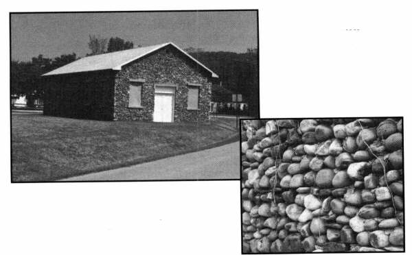
Rush was a flourishing zinc mining community from 1880 until zinc prices collapsed after World War I. In addition to the mines and mining-related buildings, there were houses, stores and barns which continued to be occupied even after the mining era. Some houses were lived in until the 1960s. The whole area, 1,316 acres, is on the National Register of Historic Places.
I climbed up to where the mine workings were located, some 200 feet up the mountain, above the valley floor. For safety's sake, they are now sealed off, as are the historic buildings. To me, I found these remaining houses and stores along the Rush Creek valley, the places where people lived and traded, to be more interesting than the mines themselves.

[19]
I knew these standing buildings had all been built on Morning Star Mining Company land, so I expected them to have the identical look of most company towns. Surprisingly, however, they were of different designs, built I later learned, by local craftsmen using local materials from the area sawmills. These buildings have suffered from weather and vandalism, but taken as a whole I found myself wandering about in a ghost town that retained much of the feel and flavor of its boom days.
Above Rush, the fiver winds its way through the Lower Buffalo Wildemess Area until it joins the White. I didn't get to see this part of the fiver, because there are no maintained roads or access points. It is indeed, wilderness.
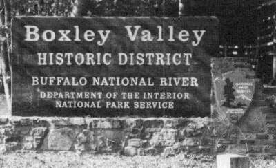
The Boxley Valley
As the river ends, so it begins, in wilderness- the Upper Buffalo Wilderness Area. I didn't get to see it, but I'm told that the Buffalo rises in the highest part of the Boston Mountains, at an elevation of over 2500 feet. Ken Smith describes its beginnings poetically in his book, The Buffalo River Country.
Just a spot, a tiny bit of a pool cupped in the fallen leaves. Small, unobtrusive. Limpid, liquid.., in contrast to its matrix of brittle brown leaves. Water.
It comes silently, invisibly from under the leaf bed. It leaves quietly, glistening on a rock, sliding over and down...dripping...

The river gains strength rapidly.By the time it reaches the beginning of the Boxley Valley it has descended nearly 1400 feet and picked up the water from a number of small tributary streams. It is now a real river.
Boxley Valley has a wide, straight modem highway running through it. There is no town of Boxley now, only a Park Service sign. But as I drove from Boxley bridge to Ponca, I found it easy to understand why this section of the Buffalo attracted settlers in the first place, and why it has remained populated while other communities along the Buffalo have faded and died. The active farmsteads, attractive homes, and the obviously thriving Baptist church in the shadow of the historic Boxley community building, attest to a prosperous neighborhood.On the way to Ponca, I left the highway at the Lost Valley sign. I want to make the two-mile hike into Lost Valley sometime, but I felt I didn't have time then. I did however, drive up a dirt road to the Beechwood Church and cemetery. It is a very attractive and peaceful place. I understand that occasional community church services are still held there.
So much more could be said about this beautiful area. Elsewhere in this issue Julie Bloodworth has written about Ponca in a sidebar to her story about Ozark Ecotours, and articles by Jim Liles and Robert Flanders tell more about the Boxley Valley place and people. I'll leave the valley to them.
Jasper
I found that getting to Jasper from Ponca was half the fun of being there. The first nine miles on highway 74 are steadily uphill with many switchbacks, bends, and curves. You go through Low Gap, past the turnoff to Kyle's Landing and Camp Orr (a Boy Scout camp on private property within the Park boundary), and come to Mt. Sherman. After Mt. Sherman the road eases back down somewhat, for the next five miles or so, into Jasper, the busy, bustling county seat of Newton County, population 324. There are three Buffalo River county seat towns-Yellville in Marion County, Marshall in Searcy County, and Jasper. Jasper is the smallest of the three, but it is also the closest to the river, so it is a place humming with tourist activity.
[20]
Scenic highway 7 runs fight through the square, so the traffic is constant. I had a great hamburger and fries at a restaurant on the square, in preparation for the trip back north.
Pruitt, Erbie, and The Parker-Hickman Farmstead
I went north on highway 7 out of Jasper, heading for Pruitt. There is a Ranger Station right on the fiver at highway 7. The ranger on duty told me that the building we were in was originally the Pruitt general store, service station, and post office, dating from the 1930s. Most of the trucks parked outside belong to the Park Service, and the old general store is, now, humming with airconditioners, and bristling with radio antennas.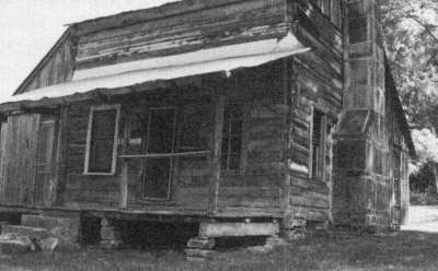
Backtracking a bit, I took a five-mile gravel road over to Erbie, and the Parker- Hickman farmstead. It's an excellent road, wide, smooth, and well-maintained by the National Park people. It's a beautiful drive too, along the fiver, and under a canopy of trees much of the way. I stopped for a minute to visit the Brown Cemetery, walking into it through a large rough-sawn gate with a wood-sliding latch. The cemetery is deep in the woods-a most peaceful place.
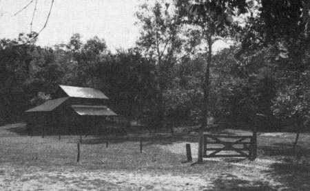
The centerpiece of the Parker-Hickman farmstead, which is on the National Register of Historic Places, is a superbly constructed, hand hewn cedar log cabin with a massive stone fireplace. A plaque at the site says that the home was presumably built by one of the early Parker families somewhere between 1835 and 1857. But there are other structures as well, including a privy, smokehouse, chicken shed, machine shed, a board barn and a log barn, a granary, and perhaps more. Some of these structures are much newer than others, for the farm was continuously occupied until 1982.
The delight I found in the farmstead was the opportunity to wander about the grounds by myself, into and through any of the buildings. There were no guide ropes to keep me away from forbidden territory. I was not hurried along by other visitors anxious to occupy my spot. The visitor log showed there had been about one set of visitors per day over the last couple of weeks.
In the Spring 1989 issue of OzarksWatch, Lynn Morrow, wrote, "The Parker- Hickman complex, with its combination of nineteenth and twentieth century structures, is rare. Among officially curated sites open to the public view, it is probably unique." It is indeed unique, and a gem.
I decided to head back to highway 7, Harrison, and home to Missouri by crossing the fiver at Erbie ford and taking a chance that the road that squiggled its way up to Dogpatch on my Park Service map was really there. Let it be said that the road on the north side of the fiver was not as well maintained as the one on the south. Nor were there any significant road markers to give information about location. I obviously made it back. I did, however, get to see a lot of Arkansas timber, wildlife, and back country farmsteads.
I've got to get back, soon, and visit more of the places in Buffalo River Country that I just didn't have time for this trip. Those of us who love the Ozarks find a continuing joy in discovering, and rediscovering, our heritage, especially when it involves the special places and people of Buffalo River Country.
[21]
Copyright -- OzarksWatch
Next Article | Table of Contents | Other Issues | Keyword Search
