Sanborn Fire Insurance Maps
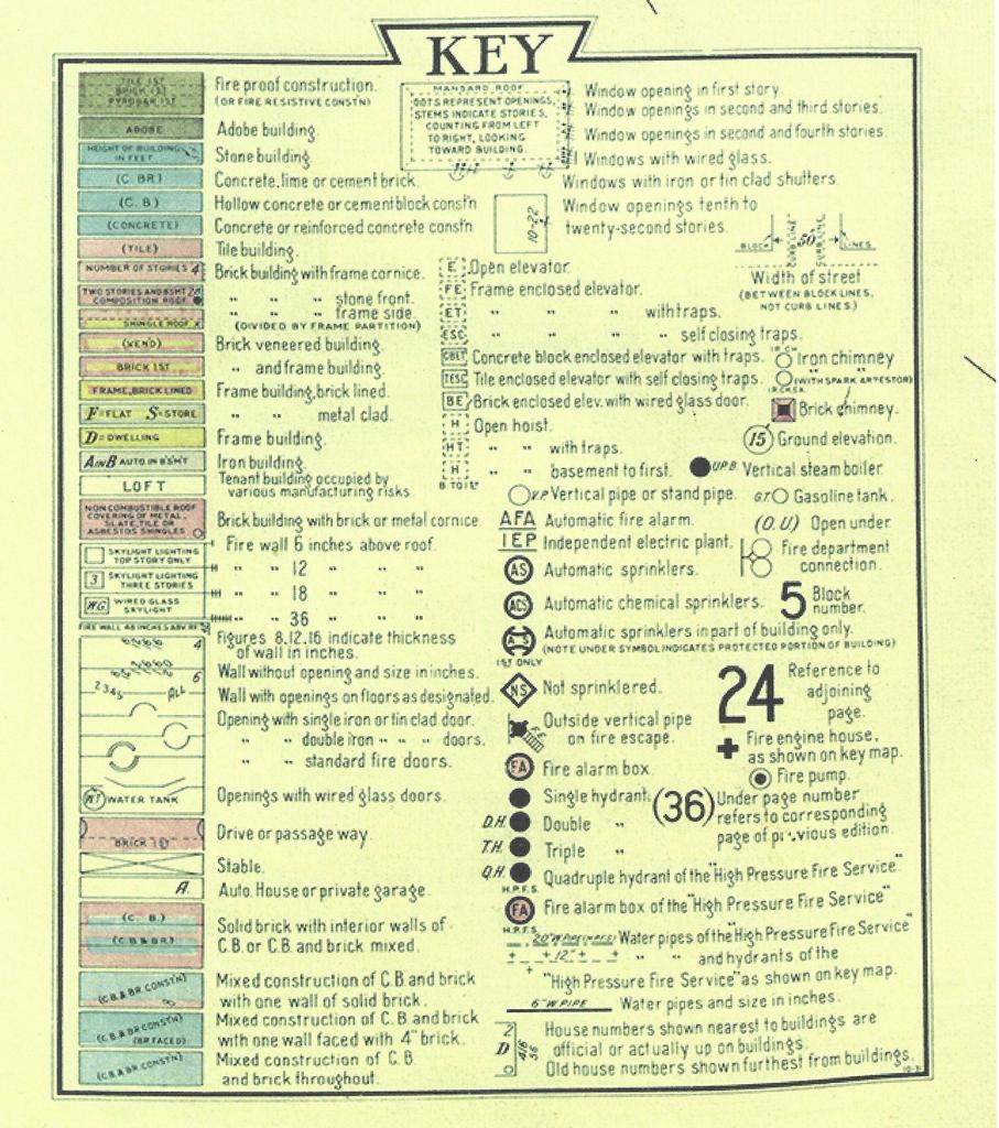 Sanborn Fire Insurance Maps were created for the insurance industry to determine the risk in policies sold to clients. The maps are street level drawings that show the footprint or outline of every building in a city or town and the physical composition of each building. Wooden dwellings are indicated by the color yellow and a “D” while a business building made of brick would be colored a pinkish color and concrete would be blue. The names of the home owners and the businesses are not included, but most public buildings and churches are named. They can also show street name changes, address changes, alleyways, springs, streams and other natural features. Generally, the maps only cover the city limits, though lightly populated parts of a town may not be included.
The books are invaluable to anyone researching their home or to genealogists to locate where family lived in the past. The following is an article from the Springfield Republican, 17 May 1910, regarding the 1910 Sanborn Map
“Make Maps of Houses in Business Section
“W. A. Randall and E. W. Powers, two expert architects and builders are in Springfield making outline maps of all the business houses in the city for the Sanborn Map Company, publishers of insurance maps. The task here will not be completed until late in June.
“This work requires much time and hard work as the construction of all the business houses on every street in the city must be carefully looked into and shown for the drawings. These and similar maps of business houses in all the important cities in America are printed in a large book and these books are sold to all fire insurance companies in the United States.”
The 1910 and earlier maps can be viewed online, in color, at the University of Missouri Digital Library. The key to the maps above is from the 1933 Springfield Sanborn Map.
Find this article at